Recharge Revisited
Local lake depth measured
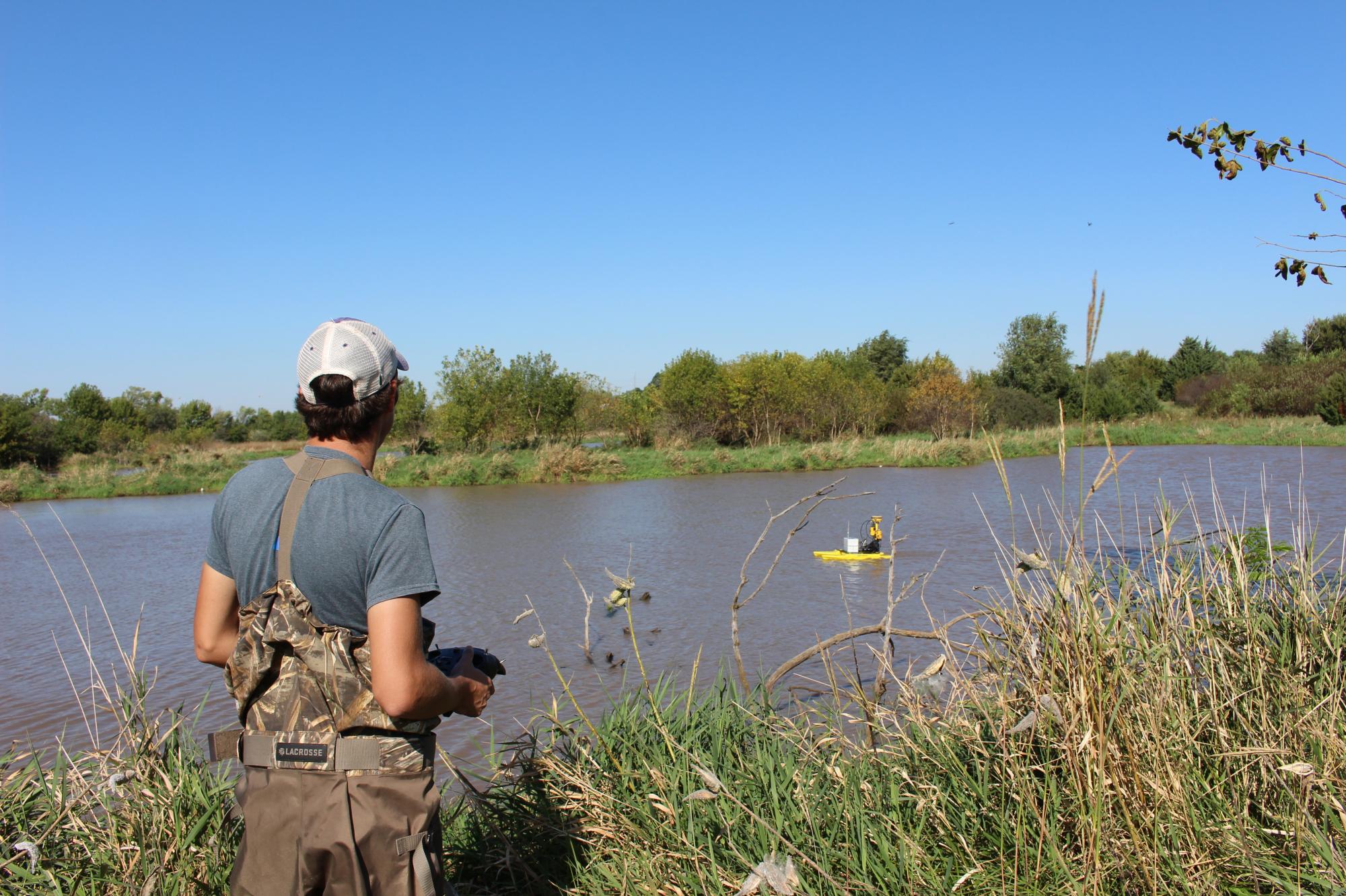
It’s a warm fall day at Recharge Lake in York. High winds make the trees and tall grasses dance on the banks as the crickets and cicadas sing their last songs of the season. A young man in camo chest waders and a ball cap stands on the water’s edge, a large remote control in his hands. His gaze is locked on a small yellow catamaran 30 feet away that skims the water’s surface, buffeted by choppy waves. The craft is loaded with scientific equipment and the operator, Will Walker, is using caution so as not to swamp the craft in the gusty conditions.Walker is a field engineer and part of a team from the Nebraska Natural Resources Conservation Service (NRCS) who are using the boat, a Seafloor HyDrone, to conduct a bathymetric survey of Recharge. The craft uses GPS and echo-sounder technology to record the various depths of the lake. This process is useful in studying the habitat health of waterbodies.
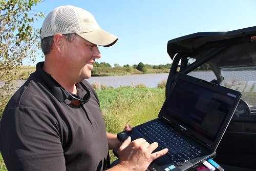
“What do you think? Is it good enough back in there?” Walker asks his colleague, Nate Garrett, gesturing to an area close to the bank on the Northwest side of the tail end of the lake. Garrett consults the laptop showing real time data transmitted from the HyDrone. Based on the readings on the screen, Garrett determines another pass of the area is needed for accuracy and Walker turns the boat back in that direction. The high winds and waves are making it hard to steer the lightweight craft with precision. The slow process of measuring the depth of the entire 44-surface-acre lake would take two days, estimates Garrett. However, they measured the main part of the lake in 2016, and so will probably spend little time on that section for this survey.
Recharge Lake (so named because of its original function: aquifer recharge) is part of Bruce L. Anderson Recreation Area, which includes RV pads, shelter house, archery range, amphitheater and other amenities. The area is managed by the Upper Big Blue Natural Resources District. Jack Wergin, projects department manager with the NRD, requested the bathymetric survey, suggesting that it should be done every 10 years or so for proper lake maintenance.
Recharge Lake used to be one of the premier fishing spots in the region. Over the years, however, the lake has filled with additional sediment from Beaver Creek during heavy rainfalls, making it shallower and murkier—qualities that negatively impact the lake’s habitability for fish. Now, the lake is populated mostly with less desirable species, such as carp and catfish, when once it delighted anglers with its abundance of bass and crappie.
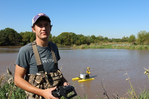
The HyDrone continues to glide silently along the surface of the water, back and forth from one bank to another. The $30,000 craft is the only one of its kind in Nebraska and is frequently used by NRCS when evaluating dam improvement projects. The mapping software on the laptop expresses a colorful array of data, indicating where the lake is shallow, where its deeper, and where trees and other debris are submerged.
“The lake is very full,” notes Garrett, pointing to areas on the computer screen map that were dry land when they surveyed in 2016 that are now several feet underwater. “It’s been a crazy year for weather in Nebraska.” Garret points to a channel near the bank where the water is six feet deep. “There are several spots like this where you should have some pretty good fishing,” he said.
Wergin and his staff will use the data collected to produce an updated topographic map and to estimate the amount of sediment that has accumulated since the last survey. The map showing lake depths will soon be available as a resource to anglers. The information gathered will help the NRD determine if work needs to be done to trap sediment where the water flows into the lake to prevent further build up.
"The Recharge Lake watershed has been designated as a target area in the NRD’s draft Water Quality Management Plan," said Wergin. "The implementation of best management practices in this watershed will improve the water quality in Recharge Lake. Bathymetric surveys can be used to measure the success of these practices by tracking reservoir sedimentation rates over time.”