Water Quantity in the Upper Big Blue NRD
Each spring, NRD staff measure a network of wells across the district and report on the status of the local water level. This is a valuable indicator of the health and longevity of the aquifer on which most Nebraskans depend for domestic and agricultural uses. Without a properly managed aquifer, large scale agriculture would not be possible in the long term. The Upper Big Blue NRD sits above the High Plains Aquifer (also known as the Ogallala Aquifer), which stretches from South Dakota to Texas. This portion of the aquifer is dynamic and factors like rainfall and pumping affect how the aquifer reacts.
This year, the NRD reported a district average water level decline of 3.08 feet. This is the third consecutive year of water level decline in the district, due to the sustained drought conditions throughout the region. In times like these, irrigation best management practices are essential to safeguarding this precious natural resource.
In recent years, producers have done an exceptional job of managing use of district water resources and cooperating with the NRD on conservation activities and monitoring. Along with NRD staff measuring observation wells, all groundwater users are required to annually report their water use. This is how the NRD maintains records on historic groundwater usage. Groundwater use records are very important to the district for making informed management decisions. The 2023 district average groundwater usage was 9.56 inches/acre. The district average groundwater usage is 6.2 inches/year since 2007.
The district’s goal is to hold the average groundwater level at or above the 1978 level. In 2005, the district average groundwater level reached the “Reporting Trigger,” initiating mandatory reporting of annual groundwater use to the district and certification of irrigated acres. If the district average water level falls below the 1978 level (“Allocation Trigger”), groundwater allocation will begin.
The spring 2024 average groundwater level was 3.6 feet above the “Allocation Trigger.” While no allocation rules are currently in effect, all irrigators are encouraged to be mindful of their water usage and to manage their irrigation efficiently.
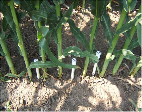
Irrigation scheduling is a critical part of good irrigation water management. Over-irrigation increases production cost, can reduce crop yields, and leaches nitrates out of the crop root zone which pollutes the groundwater. Simple management tools are available, which can help the irrigator decide when it is appropriate to irrigate and when he or she can wait.
The district sells several of these tools at a fifty-percent (50%) discount to irrigators in the district. The equipment is also for sale to others at regular prices. The irrigation scheduling equipment available includes moisture sensors, handheld meters, data loggers, evapotranspiration gauges, and soil probes.
Allocation and Pooling
The district is well prepared in case of a groundwater shortage. Groundwater allocation rules and regulations were set by the Board of Directors in 1978 and have been updated several times in the past 45 years. Action by the Board of Directors of the NRD is the only way to modify these rules. Allocation is defined as the apportioning of groundwater. The district has allocation rules for agricultural, municipal, and other groundwater users.
If the groundwater level falls below the threshold set in 1978, allocation rules and regulations would become effective on January 1 of the following year. The Board of Directors will set the duration of the groundwater use period and allocation amount by September 1 prior to the start of the initial and each subsequent groundwater use period. Current rules allow for the first groundwater use period to be for 36 months; the second groundwater use period, if enacted, would be for 60 months. The groundwater allocation for the first groundwater use period (36 months) would be 30 inches per certified groundwater use acre. The groundwater allocation for the second groundwater use period (60 months) would be 45 inches per certified groundwater use acre.
Allocation pools allow groundwater users flexibility to use allocation water over multiple fields based on well, owner-operators, or agreement pool. For the specific rules for pooling, see District Rule 5, Chapter 12. The NRD has also begun to mail pooling and allocation summary documents to producers so they have a better understanding of how allocation rules might impact their operation in the future.
If you have questions about water levels, irrigation scheduling equipment, or allocation, please contact NRD Water Department Manager Terry Julesgard at tjulesgard@upperbigblue.org or call the office at (402) 362-6601.
Notes on Reporting
The work of managing our natural resources depends on everyone in the district working together, and that includes landowners as well as tenants!
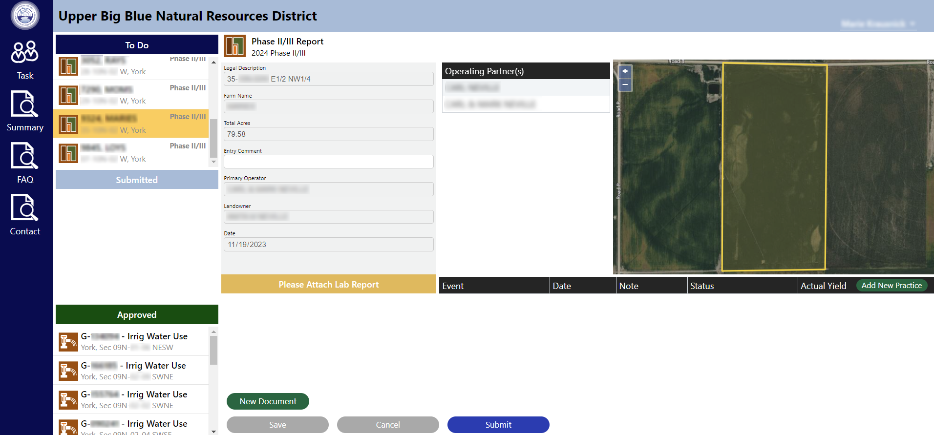
Many reports can be submitted online through our reporting platform (an anonymized screenshot is below) or by completing paper forms and mailing them to the NRD.
- Reporting: Each year there are a few reports that need to be completed and submitted by the person who is operating your acres or their authorized agent. The consequences of not completing these forms may include cease-and-desist orders for irrigation or fines.
- Nitrogen Use: For acres in the Hastings Wellhead Protection Area or a Phase II or Phase III nitrogen management area (this includes all or parts of Adams, Clay, Hamilton, Polk, Seward, and York Counties), a form must be submitted to the NRD regarding nitrogen management practices and soil analysis each year by April 1. This form will contain data for each field including information used to calculate a recommendation for nitrogen application.
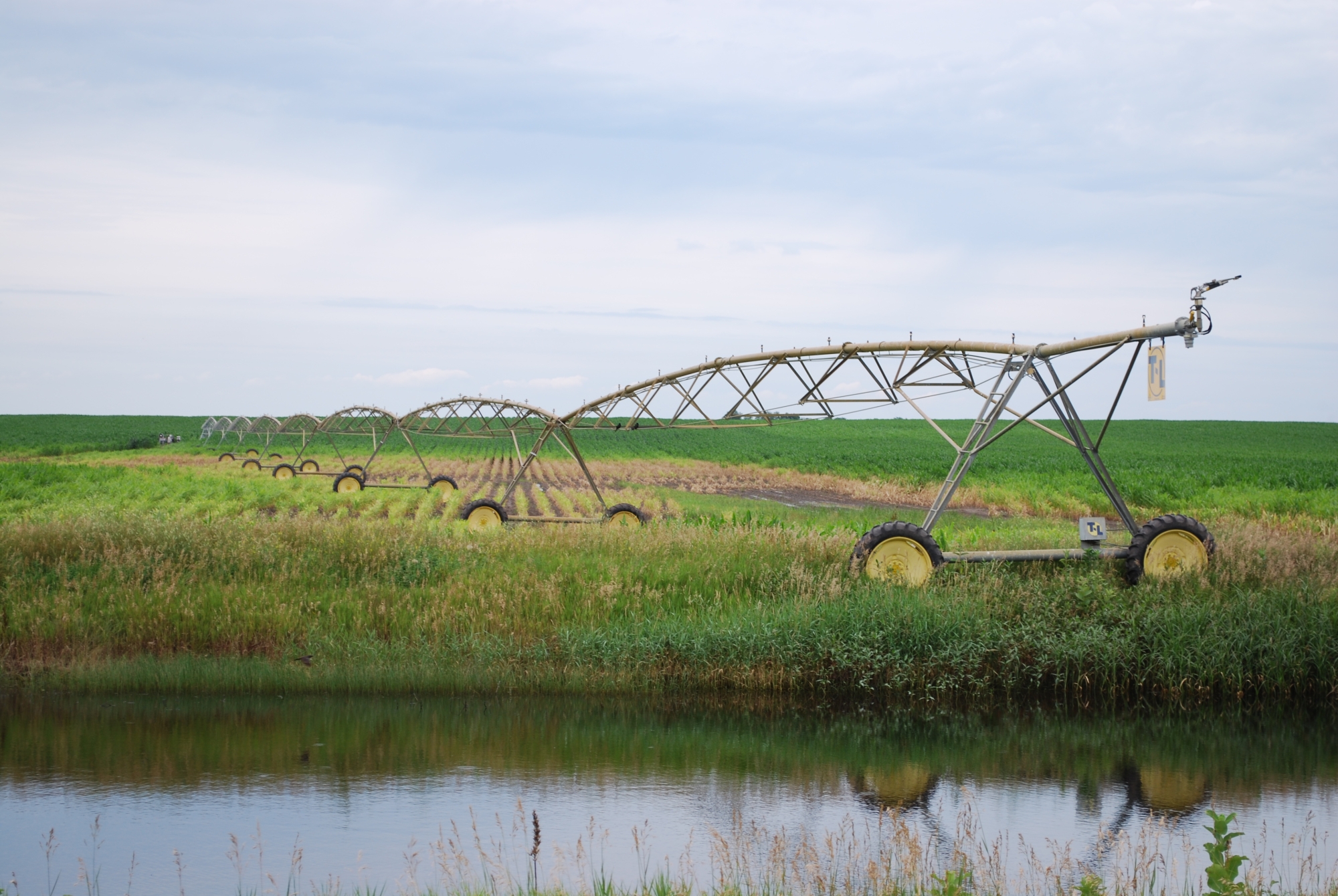
- Irrigation Withdrawal: For irrigated acres, the amount of water pumped per well each year must be reported by December 1. This amount is determined by flowmeter readings reported by the operator. All irrigation wells in the district are required to have a functioning flowmeter.
If you have changes to your number of certified acres or a different person should be listed as the operator of those acres, please let us know! Send this information to water@upperbigblue.org or call (402) 362-6601.